Modern geographical research methods form the foundation of research at the Institute of Geography and Geocommunication at Heidelberg University of Education. Staff members investigate current disciplinary, methodological and didactic issues in projects across the globe. From continuing professional development programmes in environmental education to the satellite-image-based analysis of environmental changes – the fields of research cover a broad spectrum of geography.
Research at the Institute of Geography and Geocommunication comprises the division ‘Physical Geography and its Didactics’, headed by Prof. Dr Alexander Siegmund, and the division ‘Human Geography and its Didactics’, headed by Prof. Dr Klaus-Dieter Hupke.
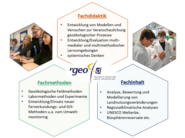
From a scientific perspective, the Department of Physical Geography specialises in the analysis and assessment of land-use changes, as well as the collection and modelling (e.g. regional climate models, scenarios for settlement development) of various spatial data, particularly those relevant to geo-ecology. Through the use of geo-ecological information systems (GÖKIS), studies are carried out into, amongst other things, degradation, vulnerability and carrying capacity, which, among other things, form the basis for the development of sustainable land-use concepts. In addition to Central Europe (particularly south-western Germany and North Rhine-Westphalia), the regional focus is on semi-arid island ecosystems such as the Canary Islands, Cape Verde and Chile.
In terms of methodology, the research projects in the Department of Physical Geography focus on the application of satellite- and aerial-image-based remote sensing techniques for environmental monitoring and geographical information systems, as well as on the further development of new media for use in the classroom.
From a subject-specific didactic perspective, the areas of work – which thematically relate primarily to current human-environment issues – focus in particular on the development of didactic concepts and interactive work and learning platforms for the use of digital geomedia such as satellite images, Geographic Information Systems (GIS), etc., in environmental education both within and outside schools. In conjunction with adaptive learning environments, this approach promotes individual learning processes and measures competences such as geographical systems literacy. The “GIS Station, Klaus Tschira Centre of Excellence for Digital Geomedia”, as an out-of-school learning venue, brings together the associated skills.
A second focus of the Department of Physical Geography is the design of environmental education concepts and teaching and learning arrangements relating to the topic of global change. Various research and development projects – ranging from young people’s perception of risks arising from global climate change to the evaluation of adaptation strategies to the consequences of regional climate change – have given rise to environmental education modules that integrate field observations, laboratory analyses and model experiments. The institute’s own ‘Geco-Lab, Centre of Excellence for Geo-ecological Spatial Exploration’ serves as a teaching and learning laboratory for investigating geo-ecological relationships, as well as for the training and further education of school pupils, students, teachers and other key stakeholders.
The ‘World Heritage’ research and work focus brings together the various areas of expertise of the Institute of Geography and Geocommunication in the field of remote sensing and GIS-supported environmental observation with the dissemination of the relevant findings to young people, key influencers and the general public. The department’s priorities in the field of Education for Sustainable Development are further consolidated through membership of the interdisciplinary Institute for Natural Sciences, Technology and Society (NTG) at Heidelberg University of Education and close cooperation with the Heidelberg Centre for the Environment (HCE) at the University of Heidelberg.